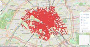
PARIS TO DOWNLOAD comes with a double purpose: it is first designed to provide a dataset for historians to download with one simple click. Click the image below and an SPARQL query will bring the adresses of Paris c. 1830 onto a modern map.

Move your cursor to the right margin and you will get the menu that allows you to download the raw data behind this visualisation to your computer. TSV (or CSV) is the practical format here, ready to bridge with copy and paste into any spreadsheet. The download will come with the geographic coordinates and the address names, CC0-licensed and ready to use in any software environment of your choice …
… This might, however, not be the most interesting use you can make of this data set. It might be far more attractive to create your own visualisations here on FactGrid with information you can put on any of the items underneath the visualisation. You will need an account to augment information on this data set and we are eager to open these accounts to all researchers working on historical Paris.
[...]